Large Scale Central

Aerial Views of Layouts

My layout design incorporates two individual track loops that are visually separated from each other in most places. These loops come together at Rico. The outer loop represents the Rio Grande Southern (RGS) main line and Rico serves as the division point. The inner loop represents the Choctaw Coal & Railroad Company (CC&R) branch line, which serves as both a source and a destination for RGS traffic.

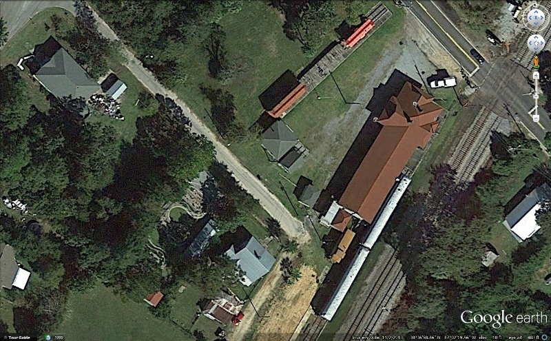
Most of the layout is under large oak trees (a blessing in the summer but not quite as nice when the leaves are falling.) In the following Google Earth image you can see bits of the layout peeking out from under the trees between my house at the upper left and my railroad shop at the lower right.

I highly compressed this image to conserve space, but you can still see some of the details including part of the Ophir Loop at the right center, the Rico yard (closest to the railroad shop), and the log dump at Sawpit (directly south of the house.)

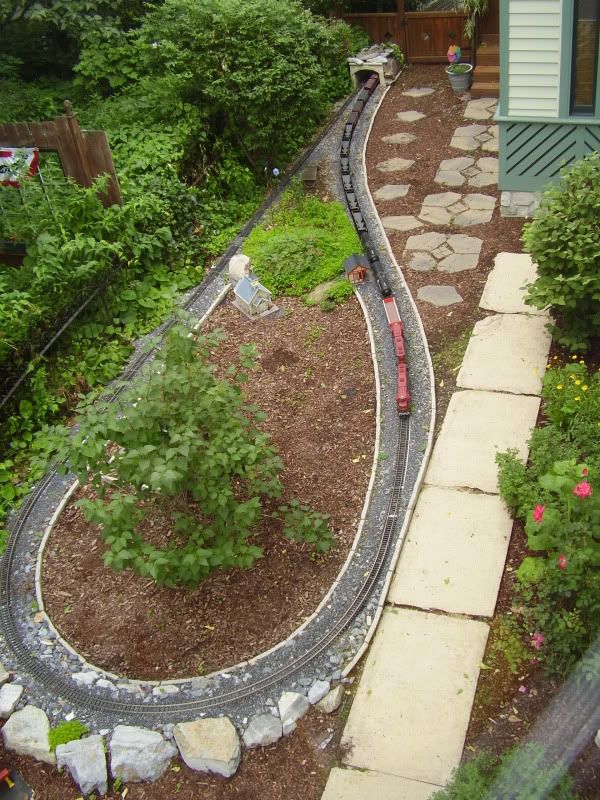
Has anyone else taken a look at their layout to see it like the folks on the space station do? If so, post your images here.

We are still waiting for better resolution of our area from Google Earth, but I’m sure that will be low on their priority list.

The current sat pics are better lit than the last batch. You can clearly make out about half the RR, if you are familiar with it.

Sometimes you just get lucky! This Google Earth image was snapped during Marty Cozad’s annual “Battery-Powered Steam-up” at Nebraska City, NE back in September 2012.

Just in case you are not familiar with this fabulous layout, see my video post at http://largescalecentral.com/forums/topic/20481/garden-railroad-magic to see what you missed. Sadly, the annual get-togethers were discontinued this year and the layout is not currently in service.

This one too, is a bit better then the last one I had. Not as much is shadow.

(http://i253.photobucket.com/albums/hh58/rgseng/RGSlayoutimage01_zpsc26f8a8b.jpg)

At our open house a couple weeks ago, someone brought a “drone” with an HD video.

He was having a blast videoing the action until a propeller hit a palm leaf on the overhead tree and it crash-landed on the tracks just in time for the GP-9 to smash into it.

Below is a pic from google earth, but it’s from 2012…

Track has been laid, and operated on on all the train area’s indicated…

(http://freightsheds.largescalecentral.com/users/jeclarke/2012%20sky%20pic%20of%20the%20railroad%20.jpg)

Andy - That’s amazing!!!

No such luck for me. The latest image was taken last summer right about this time. All you can see is my RV and the pad for my trailers. Everything else, including all of the house is under the canopy or in the shadow of many large trees.

Todd Brody said:

At our open house a couple weeks ago, someone brought a “drone” with an HD video.

He was having a blast videoing the action until a propeller hit a palm leaf on the overhead tree and it crash-landed on the tracks just in time for the GP-9 to smash into it.

LOL Todd, that s funny. Not for the owner of the drone, nor the owner of the Geep, but that’s funny.

Yea, the latest picture from Google earth shows the top of the tree that my railroad runs around, reel well. The resolution is better on Bing, and the picture was taken in the fall, but I still can’t see a railroad there.

Holy cow! They caught Andy working. Note the tractor on the right of the picture. Look close, I think he’s giving the satellite the finger.

(http://freightsheds.largescalecentral.com/users/jeclarke/2012%20sky%20pic%20of%20the%20railroad%20.jpg)

I’m still waiting for him to get a shuttle bus to get from one end of the layout to the other…:wink:

More recent photo on top. Better, older photo on bottom for the Tortoise & Lizard Bash.

Ken Brunt said:

I’m still waiting for him to get a shuttle bus to get from one end of the layout to the other…:wink:

Ken, I got one for my Mom… hehehe

This is my playground. The West Florida Railroad Museum and Emerald Coast Garden Railroad Club. Long ride to get there, but got a museum to roam, a garden railroad to play on and a CSX mainline to watch. What could be better??

Arial View

Have any of you considered getting a camera equipped radio controlled quadra-copter ?

They can be bought for about $70 , and give good results , you fly it , take your video/stills and remove the cartridge to your computer for viewing .

DO NOT consider a scale chopper , they are a swine to fly . Quadra copters are a doddle .

Mike Brit

Bob Cope said:

What could be better??

Hot coffee in the morning, and a few Duncan Donuts???

Too many trees around my place to see the RR from Google earth but this is still and aerial shot of the loop on the southern end.

David Russell said:

Too many trees around my place to see the RR from Google earth but this is still and aerial shot of the loop on the southern end.

Who’d you bribe to get that shot.?

I had a pic from a few years back, but I decided to see if Google had updated and they have. It is obviously taken this past winter in Jan or Feb. But it allows you to see the layout real well.

(http://i1128.photobucket.com/albums/m489/jake3404/homewinter_zps3283491b.jpg)

Its not usually that brown. And I can tell the river is off as there is no water flowing down the stream.

This is best I can do with Google Earth, however I did take an aerial shot of the pizza at the last show:

http://youtu.be/QOOxzm5wqg4?list=UUrUkVNWoC7txLnsbdfOQFgA

:wink: