I’ve had this link stored in my favorites for a long time. I just happened upon it again today. In the late 1800’s and early 1900’s the Panoramic Map was a popular style to depict the streets and buildings of cities with a bird’s eye view. Similar to what we can do today in Google Earth using satellite imagery. What’s amazing about these early maps is that they were drawn without the aid of aerial photography. They usually aren’t drawn to scale, but they have a pretty reasonable representation of spacial relationships, especially near the center. You can find maps for your favorite locations here: Library of Congress You can download very hi resolution scans of the images in JPeg 2000 format. Irfanview, a free image viewer, has plug-ins available for the .JP2 image format. Here is a sample of a section of the Danbury, CT map from 1875, shrunk to fit your screen 
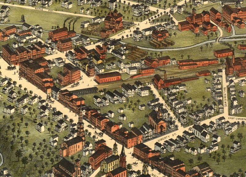
At the center of this image is the stub terminal of the Danbury & Norwalk railroad. Neither the station, nor the tracks exist today. A new union station was built near the top corner of this image that was shared with the Housatonic Railroad. Danbury Union Station still exists today as the home of the Danbury Railway Museum.